

- Webcode: 431404 • Mfr: TERRA PRO + P4 RTK
- FREE SHIPPING Available
Product Highlights
- DJI Terra Pro Overseas + Phantom 4 RTK + D-RTK 2
- 1 Year Coverage
- Transforms drone data into digital 3D models
- Maps for easy analysis & decision making
- Capture, visualize and analyze aerial images
- Ideal for safety, construction, infrastructure, agriculture & film industries
- Toronto Special Order
- Ottawa Special Order
- Mississauga Special Order
- Calgary Special Order
- Edmonton Special Order
Overview
DJI Terra
DJI Terra is a software tool that transforms drone data into digital 3D models and maps for easy analysis and decision making.
DJI Terra enables businesses and organizations using DJI drone technology to capture, visualize and analyze aerial images for a wide variety of applications across the public safety, construction, infrastructure, agriculture and film industries.
Make the World Your Digital Asset
Capture, analyze and visualize your environment with DJI Terra – an easy to use mapping software developed to help industry professionals transform real-world scenarios into digital assets.
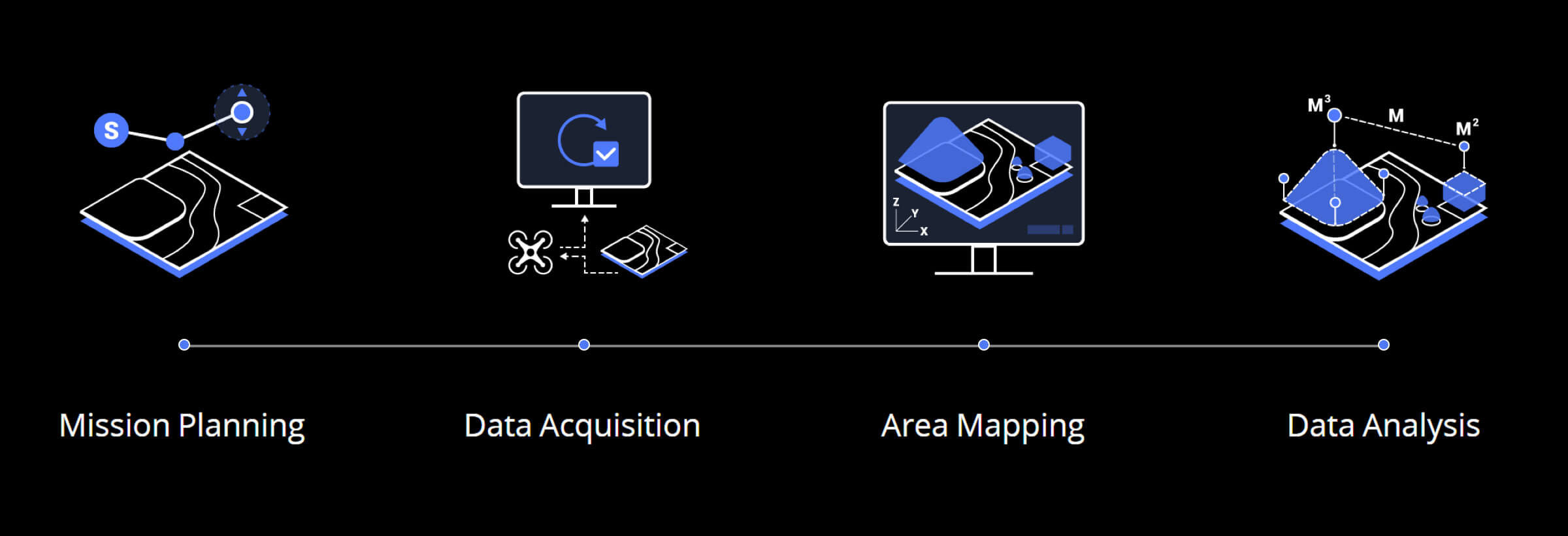
- Mission Planning
- Data Acquisition
- Area Mapping
- Data Analysis
Digitize the World Around You
Waypoints Mission Planning
Create efficient flight paths using predefined waypoint actions and adjustable parameters like altitude, speed, gimbal pitch angle, aircraft heading and more. For more complex and tight missions that require high attention to detail, use 3D Flight Visualization to design and simulate tasks on existing 3D models.
Area Mission Planning
With just a few taps on the screen, you can automate complex missions, allowing you to seamlessly capture imagery which can be processed to produce a variety of maps and models for further analysis, and to aid decision-making.
Oblique Mission Planning
When accuracy is essential and details are vital to your critical operations, Oblique lets you capture a rich 3D model data set by adjusting the angle of the camera at a
Mapping
Real-time Mapping
With real-time mapping, you can quickly generate a 2D orthomosaic of the selected area of the flight mission in real-time. Not only is this ideal for creating detailed flight paths in remote areas but it’s also useful for time-sensitive missions that require quick decision-making on site.
2D Reconstruction
Generate high resolution orthomosaic, enabling you to get detailed and accurate measurement results for all your critical projects.
3D Reconstruction
Get sharp and realistic representations of your surroundings throughout various industrial applications, be it accident reconstruction, tracking progress on major construction projects and more.
Data Analysis
2D & 3D Measurements
Acquire key dimensions across an array of terrains with easy-to-use analysis tools that enable you to obtain a variety of measurement data based on linear, area and volumetric measurements.
- Coordinate
- Distance
- Area
- Volume
Annotation
Edit labels of measurements on existing models, which can be used for reporting and improving communication throughout ongoing projects.
Photo Inspection
Closely inspect every photo of the model so you can pinpoint and highlight any critical elements in the real world.
Reviews
Questions & Answers
DJI Phantom 4 RTK with D-RTK 2 Mobile Station and Terra Pro - 1 Year License
Looking for a personal touch? Not sure if you are choosing the right product? Our staff is here to help.
We want to make sure you get the right product for your needs.
Our staff will help you understand the options available so you can be confident in your purchase.
As the country’s leading Professional Imaging retailer, Vistek is in the perfect position to ensure you make the right choice.
Contact us today for a personal touch.