How DJI Drones Empower Public Safety Teams
Immediate Intel
Provide incident commanders with detailed information of remote operations

Informed Responses
Effectively direct your resources with a constant stream of aerial intel
Enhanced Safety
Keep ground teams safe with robotic scouting of the area
Public Safety Applications
Improve your daily operations with DJI drone solutions
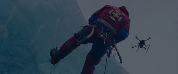
SEARCH & RESCUE
Response teams often navigate through vast, challenging and dangerous terrain to save lives. DJI technology brings semi-automated tools that quickly scout these regions and locate those in danger without risking members of the team.
MOUNTAIN RESCUE
Response teams often navigate through vast, challenging and dangerous terrain to save lives. Our technology brings semi-automated tools that quickly scout these regions and locate those in danger without risking members of the team.
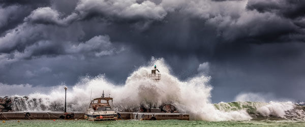
MARITIME RESCUE
DJI drone solutions efficiently scan the ocean for those lost at sea. Search teams can use thermal and zoom cameras to sweep large bodies of water even in low visibility, locate heat signatures, and initiate a rescue.
RESOURCE TRACKING
DJI drone solutions provide a visual feed of large disaster areas to help incident commanders make informed decisions. With a drone’s live stream, they can more effectively direct on-the-ground teams and communicate the situation to off-site stakeholders.
STRUCTURE FIRE
DJI drone solutions give teams a real-time 360 ° view of a burning building. By using thermal imagery to monitor fire progress and spot victims through the thick smoke, commanders can efficiently target attacks without risking firefighters..
FORREST FIRE
DJI drone solutions monitor large-scale wildfires to provide detailed, around-the-clock information to commanders. By using thermal and zoom imagery, commanders can immediately locate hotspots and zoom in to check on teams and resources status.
HAZMAT RESPONSE
DJI drone solutions enable first responders to tackle HazMat situations better whilst maintaining their own safety. With simultaneuous thermal and visual imagery, response teams can quickly identify where a dangerous substance is located and what material it is.
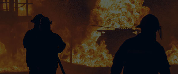
FIREFIGHTING
Putting out a fire requires a balance of heroism to save lives trapped in a burning structure and caution to prevent flames from spreading. DJI technology brings rapid imaging tools that provide critical information to best attack the fire while maintaining firefighter safety.

LAW ENFORCEMENT
Officers are often required to put themselves in harm's way to protect citizens and uphold the law. DJI drone technology provides them with remote imaging tools so that they can assess a situation and plan response accordingly, drastically improving officer and bystander safety.
ACCIDENT FORENSICS
DJI drone solutions quickly map areas after an incident to preserve the scene for further analysis. By using 3D maps or aerial LiDAR point clouds, forensic units can gain a detailed view of a site and provide an unbiased, visual report to the courts.
INCIDENT SCOUTING
DJI drone solutions provide remote visuals of a dangerous area to give officers critical information of a situation. By using a thermal sensor, officers can gain visuals through glass and other obstructions, preventing officers from risking their lives when scouting an area.
DISASTER RESPONSE
DJI drone solutions provide immediate aerial overviews to identify missing persons. With a drone’s live stream, response teams can efficiently direct on-the-ground teams and communicate the situation to off-site stakeholders.
DISASTER PREPAREDNESS
DJI drone solutions generate detailed maps of jurisdictions to prepare teams before disaster strikes. By generating 3D models of critical sites, teams can simulate disasters to create optimal emergency response plans.
POST_DISASTER ASSESMENT
DJI drone solutions collect the visual data of affected areas and assets to assess damage and plan repairs accurately. By using automated mapping missions, insurers can quickly prepare and conduct missions that analyze damage across multiple cities.
DISASTER MANAGEMENT
When natural disasters hit, response teams instantly come together to save lives and start rebuilding. DJI drone technology brings rapid data collection tools to responders, infrastructure maintenance teams, insurers, and more to quickly visualize areas, coordinate activities, and start rebuilding communities.
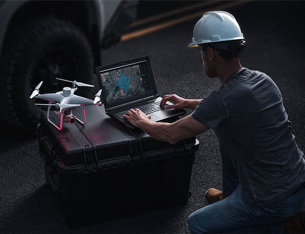
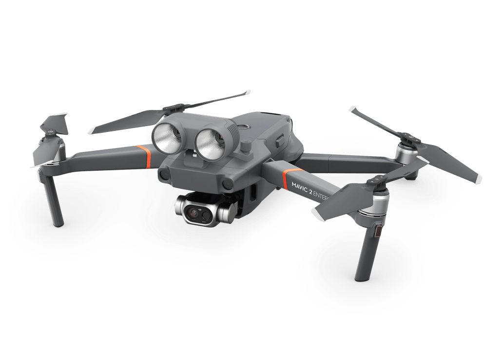
Quick Deployment Tactical Tool
An all-in-one drone platform that equips teams with an easy-to-use aerial tool, providing close range task support during critical incident analysis.
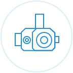
 M2E Dual
Adaptable Platform
 Modular Accessories
Mission-Adaptable Tools
Rapid Mapping Solution
All-in-one package for teams to quickly map areas before and after events to ensure preparedness and conduct data-driven post-disaster assessments.
Mavic 2 ProImaging Platform
 GS Pro
Flight Planning
 Software
Image Stitching Tool
Mission Operations Solution
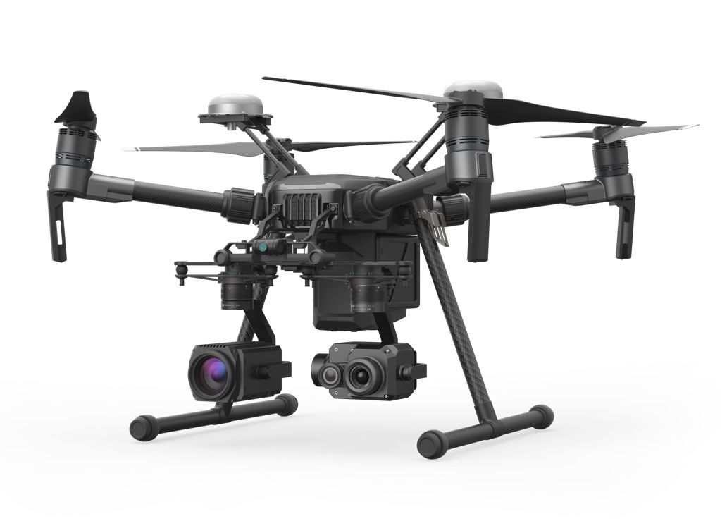
Rugged aerial platform to oversee operations and identify threats in all situations to help incident commanders effectively direct their teams.
 M210
M210Adaptable Platform
 Zenmuse XT2
Thermal Imaging
 Zenmuse Z30
30x Optical Zoom