

- Webcode: 465850 • Mfr: 279522
- FREE SHIPPING Available
Product Highlights
- 20 MP 4/3 CMOS Sensor
- f/2.8 - f/11 Aperture Range
- Up To 4K: 3840×2160 @30fps Max. Resolution
- ISO 100-6400 ISO Sensitivity
- 3-Axis Image Stabilization
- IP54 IP Rating
- Toronto Special Order
- Ottawa Special Order
- Mississauga Special Order
- Calgary Special Order
- Edmonton Special Order
Overview
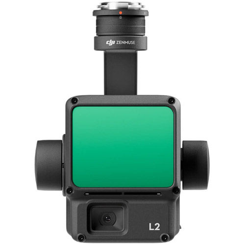
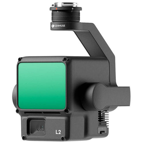
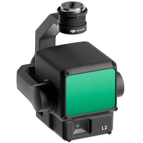
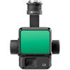
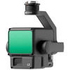
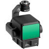
Zenmuse L2 SP Plus
Powerful Range, Elevated Precision
Zenmuse L2 integrates frame LiDAR, a self-developed high-accuracy IMU system, and a 4/3 CMOS RGB mapping camera, providing DJI flight platforms with more precise, efficient, and reliable geospatial data acquisition. When used with DJI Terra, it delivers a turnkey solution for 3D data collection and high-accuracy post-processing.
Integrated LiDAR Solution
Supported by its powerful hardware, L2 can allow for a precise scan of complex subjects within an extended range and faster point cloud acquisition. During operations, users can preview, playback, and process point cloud models on-site, with Task Quality Reports generated by DJI Terra, offering a simple, one-stop solution to improve overall efficiency. This enables users to achieve high-precision point cloud results with one-stop post-processing.
High-Level Precision
By combining GNSS and a high-accuracy self-developed IMU, this solution achieves 4cm vertical accuracy and 5cm horizontal accuracy.
Exceptional Efficiency
It’s ready for work as soon as it’s powered on and can collect both geospatial and RGB data from a 2.5km2 area in a single flight.
Intuitive Operation
In conjunction with Matrice 350 RTK (or Matrice 400), DJI Terra, and DJI Modify, L2 offers a turnkey solution that is simple to use, lowering the operational threshold.
Frame-Based LiDAR
30% Detection Range Increase
L2 can detect from 250 meters at 10% reflectivity and 100 klx, and up to 450 meters at 50% reflectivity and 0 klx. The typical operational altitude now extends up to 120 meters, notably enhancing operational safety and efficiency.
Smaller Laser Spots, Denser Point Clouds
With a reduced spot size of 4×12 cm @100m, only a fifth of that of L1, L2 not only detects smaller objects with more details, but can also penetrate denser vegetation, generating more accurate digital elevation models (DEM).
Supports 5 Returns
In densely vegetated areas, L2 can capture more ground points beneath the foliage.
Effective Point Cloud Rate: 240,000 pts/s
In both single and multiple return modes, L2 can reach a max point cloud emission rate of 240,000 points per second, allowing the acquisition of more point cloud data in a given time frame.
Two Scanning Modes
L2 supports two scanning modes, offering flexibility for users based on their task demands. In repetitive scanning mode, L2's LiDAR can achieve more uniform and accurate point clouds while meeting high-precision mapping requirements. In non-repetitive scanning mode, it offers deeper penetration for more structural information, making it suitable for power line inspection, forestry surveying, and other scenarios.
Frame-based Design
The frame-based design results in an effective point cloud data rate of up to 100%. Together with a three-axis gimbal, it brings more possibilities to surveying scenarios.
High-Accuracy IMU System
No IMU Warm-up
The performance of the IMU system has been significantly enhanced, and it is ready for use the moment it's powered on. And, the accompanying drone is ready to begin tasks immediately once the RTK is in FIX status, delivering an optimized in-the-field experience.
RGB Mapping Camera
4/3 CMOS, Mechanical Shutter
Pixel size has been enlarged to 3.3 μm, and effective pixels now reach 20 MP, resulting in a significant improvement in overall imaging, as well as more enriched true-color point cloud details. The minimum photo interval has been reduced to 0.7 seconds. The mapping camera has a shutter count of up to 200,000 times, further reducing operational costs. When point cloud collection is not needed, the RGB camera can still take photos and videos, or collect images for visible light mapping.
Enhanced Operational Experience
Power Line Follow
Zenmuse L2's intelligent recognition algorithm supports identification, tracking, and junction analysis for transmission and distribution lines, enabling semi-automatic flight and data collection.
Diverse Flight Route Types
Supports Waypoint, Area, and Linear Route types, for handling surveying tasks in a variety of environments.
Point Cloud LiveView
During operation, DJI Pilot 2 supports three display modes - RGB, point cloud, and point cloud/RGB side-by-side display, presenting operational results in an intuitive way. Activating RNG (Laser Rangefinder) enables access to the distance information between the LiDAR module and the object in the center of the FOV, enhancing flight safety. It also supports four real-time point cloud coloring modes - Reflectivity, Height, Distance, and RGB.
Point Cloud Model Playback & Merging
After the operation, the 3D point cloud model can be viewed directly in the album. 3D Point cloud models of multiple flights can also be merged, enabling on-site decision-making regarding operational quality.
Auto-Generated Task Quality Report
After point cloud data collection, the DJI Pilot 2 app will automatically generate a Task Quality Report so that operators can check operational results in real-time and on-site, making fieldwork more responsive and worry-free.
PPK Solution
In complex operational environments, users can set up RTK base stations before the operation to preemptively avoid the loss of RTK data due to interference, video transmission disconnection, or other issues. After the operation, import original files into DJI Terra to use the PPK (post-processing kinematic) process to rebuild high-precision models.
One-Click Processing on DJI Terra
Achieve efficient and reliable one-stop post-processing when importing point cloud data into DJI Terra. Generate a standard-format 3D point cloud model with just a click after point cloud trajectory calculation and accuracy optimization. Upon ground point classification, using Ground Point Type, a DEM can be output. Point cloud quality can be analyzed with the Accuracy Control and Check function.
Application Scenarios
In coordination with DJI Enterprise flight platforms and DJI Terra, Zenmuse L2 can be applied to land surveying and mapping, electricity, forestry, and infrastructure management, as well as other scenarios.
Reviews
Product Specifications
Zenmuse L2 |
|
|---|---|
General |
|
| Dimensions |
|
| Weight |
|
| Power |
|
| IP Rating |
|
| Supported Aircraft |
|
| Storage Temperature |
|
| Operating Temperature |
|
System Performance |
|
| Detection Range | 450m @50% reflectivity, 0 klx 250m @10% reflectivity, 100 klx |
| Point Cloud Rate |
|
| System Accuracy | Horizontal: 5 cm @ 150 m Vertical: 4 cm @ 150 m |
| Real-Time Point Cloud Coloring Coding |
|
LiDAR |
|
| Ranging Accuracy | 2 cm @ 150 m |
| Maximum Returns Supported | 5 |
| Scanning Modes |
|
| FOV |
|
| Minimum Detection Range |
|
| Laser Beam Divergence | Horizontal 0.2 mrad, Vertical 0.6 mrad |
| Laser Wavelength |
|
| Laser Spot Size |
|
| Laser Pulse Emission Frequency |
|
| Laser Safety |
|
|
Accessible Emission Limit (AEL) |
|
| Reference Aperture |
|
|
Max Laser Pulse Emission Power Within 5 Nanoseconds |
46.718 W |
IMU System |
|
|
IMU Update Frequency |
|
|
Accelerometer Range |
|
|
Angular Velocity Meter Range |
|
|
Horizontal Positioning Accuracy |
|
| Vertical Positioning Accuracy |
|
RGB Mapping Camera |
|
| Sensor |
|
| Lens |
|
| Shutter Speed |
|
| Shutter Count |
|
| Photo Size |
|
| Still Photography Modes |
|
| Video Codec and Resolution |
|
| ISO |
|
| Video Bitrate |
|
| Supported File System |
|
| Photo Format |
|
| Video Format |
|
Gimbal |
|
| Stabilization System |
|
| Angular Vibration Range |
|
| Mounting |
|
| Mechanical Range |
|
| Controllable Range |
|
| Operation Mode |
|
Data Storage |
|
| RAW Data Storage |
|
| Point Cloud Data Storage |
|
| Supported microSD Cards |
|
| Recommended microSD Cards |
|
Post-Processing |
|
| Supported Software |
|
| Data Format |
|
Questions & Answers
DJI Zenmuse L2 SP Plus
Looking for a personal touch? Not sure if you are choosing the right product? Our staff is here to help.
We want to make sure you get the right product for your needs.
Our staff will help you understand the options available so you can be confident in your purchase.
As the country’s leading Professional Imaging retailer, Vistek is in the perfect position to ensure you make the right choice.
Contact us today for a personal touch.